History of the Polish language globes
History of the Polish language globes
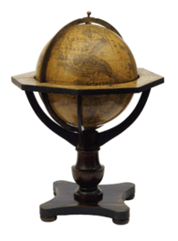
For a long time globes have been used as a teaching and didactic aids. The globe made by Martin Behaim in 1492 is the earliest one surviving which we know about in modern times. In the past, the names on the globes were written either in Latin, in Greek or in Arabic. The first globe maps in Polish nomenclature came from Nuremberg (Abel-Klinger company, about 1840-1850) Later the globes were published by the Czech Felkl company (in the years 1861-1875), by the Felkl and Son company (since 1875) and by Räth (Räthgloben) in about 1920.
During the interwar period, globes were produced in the newly re-established Republic of Poland. After 1918 A. Nowosielski make a globe, the maps were produced by the Główczewski company from Warsaw, the copies were published by H. Wajner Pomoc Szkolna Publishing House and by Pierwsza Krajowa Fabryka Pomocy Naukowych Urania T.A. [The First Teaching Aids Domestic Factory Urania joint-stock company] (after 1921 Nasz Sklep [Our Shop] – Urania). During the course of the interwar period globe translated from the Räth company´s globes appeared, including the relief globe as well. The globes were published by Polish companies: Katowickie Zakłady Drukarskie i Wydawnicze T.A.[Katowice Printing and Publishing House joint-stock company] and Katowicka Dostawa Szkolna Kados [Katowice School Supply Kados] (which in about 1930 changed its name into Dostawa Szkolna Pestalozzi, Warsaw). The globe published in Poznań by Wydawnictwo Polskie [The Polish Printing House](about 1930) and GGGGU-NKTL in Leningrad (about 1937) was saved. In 1934 the Lviv Książnica-Atlas edited a physical globe and one year later a political globe, in both cases the author was Eugeniusz Romer.
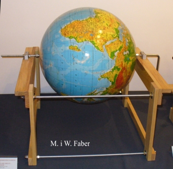
After World War II, before the monopolisation of the market by Państwowe Przedsiebiorstwo Wydawnictw Kartograficznych (PPWK) Oddział we Wrocławiu [National Cartographic Publishing House], a physical globe designed by Gustaw Wuttke and Andrzej Lorentsky (1946) appeared published by Pracownia Pomocy Naukowych “Globus” w Warszawie [Workshop of Teaching Aids “Globe” in Warsaw] and printed in Poznań. In 1951 E. Romer worked out his biggest globe (1:30 million). From 1959 up to the 1980s, the globe maps were published by PPWK and printed mostly by Fabryka Pomocy Naukowych w Warszawie [Teaching Aids Factory in Warsaw]. In the 1980s some maps elaborated by PPWK were printed by other printing houses (Włocławek, Marki). Eventually, in 1988 the maps and the copyrights were repurchased by the ZACHEM company from Rębków producing the globes until today—nowadays with maps elaborated by KARTO-GRAF from Lublin. In 1985 a globe published by Cartigraphia from Budapest found his way to Poland. Towards the end of the 20th c. two companies entered the Polish market: Scan-Globe from Denmark and Nova RICO from Italy. The latter one produces globes and telluriums, which are still being sold. In 2003 in Olsztyn Andrzej Kowalczyk worked out a globe of 1m in diameter, perfectly fit for didactic purposes.
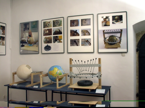
Another category is the fold-up globes. The first known study dates back to 1887 (Jan Jędrzejewicz) and of the published globes one can name The simplified globe by Wojciech Walczak and Władysław Milata (Przełom Publishing House, Cracow 1954) and The thematic fold-up dodecahedron globe authored by Stefania Gurba and Franciszek Uhorczak (UMCS Publishing House, Lublin 1976).
Publications
|
|
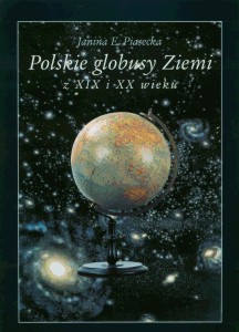
Janina E. Piasecka
Polskie globusy Ziemi z XIX i XX wieku Muzeum Lubelskie w Lublinie Oddział Dworek Wincentego Pola Wydawnictwo Marii Curie-Skłodowskiej Lublin 2004
|
|
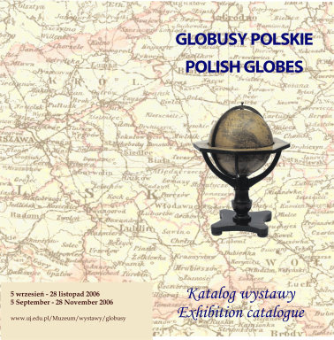
MaŁgorzata Taborska Globusy Polskie. Polish Globes Jagiellonian University Museum Krakow 2006 dowland pdf |